Mayotte Awards €11 Million Land Surveying Framework
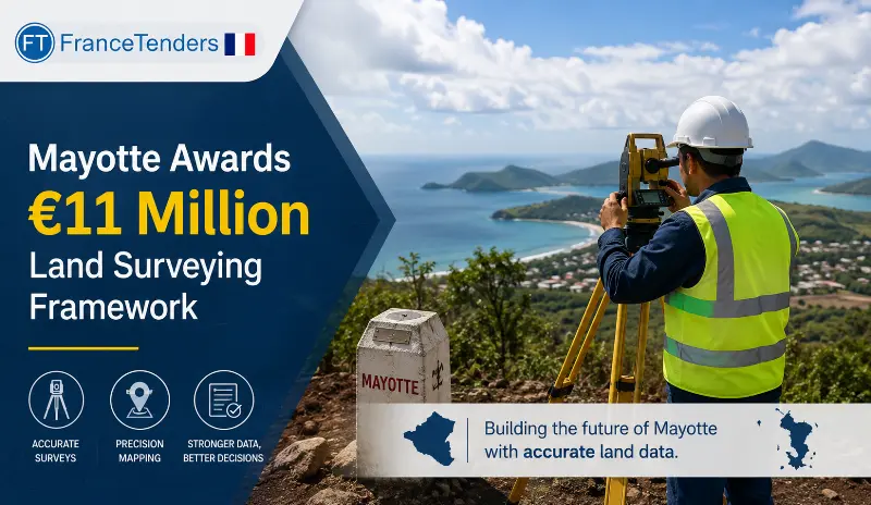
The Department-Region of Mayotte has awarded an €11 million framework agreement for land surveying services to three companies: Mayotte Topo, Geofit, and TopoLib. The framework, divided into five lots covering the island's five intercommunal areas, will secure the department's land assets, clarify property boundaries, and facilitate land registry registration.
Introduction
Land tenure security is essential for economic development, property rights, and social stability. In Mayotte, a French overseas department and region in the Indian Ocean, securing land assets and clarifying property boundaries is a critical priority.
The Department-Region of Mayotte has established a comprehensive framework agreement for land surveying services, valued at up to €11 million. The framework, divided into five lots covering the island's five intercommunal areas, has been awarded to three surveying companies: Mayotte Topo (Lots 1 and 3), Geofit (Lots 2 and 4), and TopoLib (Lot 5).
This procurement will secure the department's land assets, clarify land boundaries, and facilitate registration in the land registry, supporting property rights and economic development across Mayotte.
Why This Contract Matters
Land surveying is essential for clarifying property boundaries, securing land rights, and facilitating land registration. In Mayotte, where land tenure issues are significant, this framework is critical for economic development and social stability.
This contract matters because it:
- Secures land assets: Helps the Department-Region of Mayotte secure its land holdings
- Clarifies boundaries: Defines property boundaries to reduce disputes
- Facilitates land registration: Supports inscription in the land registry
- Significant value: €11 million framework
- Covers all of Mayotte: Five lots covering the entire island
- Quality-focused: Technical value weighted at 45%
- Three local suppliers: All winners are based in France or Mayotte
Contract Timeline
- Contract award notice published: 11 August 2026 (OJ S 153/2026)
- Contract concluded: 15 April 2026
- Coverage start date: Not specified
- Coverage end date: 48 months from start
Contract Overview
The Department-Region of Mayotte conducted an open procedure for this procurement. The framework covers land surveying services (bornage) for the department's land parcels across five intercommunal areas.
Key features include:
- Five lots: Covering five intercommunal areas across Mayotte
- Total maximum value: €11,000,000
- Duration: 48 months (with renewal options for most lots)
- Evaluation: Price (55%) and Technical value (45%)
- Framework type: Without reopening of competition
- Winners: Mayotte Topo, Geofit, TopoLib
Key Contract Details
| Detail | Information |
|---|---|
| Contracting authority | Département-Région de Mayotte |
| Winning bidders | Mayotte Topo (Lots 1 & 3), Geofit (Lots 2 & 4), TopoLib (Lot 5) |
| Contract subject | Land surveying services (CPV 71354300) |
| Procedure type | Open procedure |
| Legal basis | EU Directive 2014/24/EU |
| Total maximum value (EUR) | €11,000,000.00 |
| Number of lots | 5 |
| Contract duration | 48 Months (with renewal options) |
| Bids received | 4 per lot |
| EU funding | None |
| Covered by GPA | Yes |
| Evaluation criteria | Price (55%), Technical value (45%) |
Project Scope
The framework covers land surveying services (bornage) for the Department-Region of Mayotte's land parcels across the island. The scope is divided into five lots:
Lot 1: Communauté d'Agglomération du Grand Nord (CAGN)
- Municipalities: Bandraboua, Koungou, Mtsamboro, Acoua
- Maximum value: €3,000,000
- Winner: Mayotte Topo
Lot 2: Communauté d'Agglomération Dembéni Mamoudzou (CADEMA)
- Municipalities: Mamoudzou, Dembéni
- Maximum value: €1,700,000
- Winner: Geofit
- Renewal: Up to 3 renewals
Lot 3: Communauté de Communes du Centre-Ouest (3CO)
- Municipalities: M'Tsangamouji, Tsingoni, Chiconi, Ouangani, Sada
- Maximum value: €3,500,000
- Winner: Mayotte Topo
- Renewal: Up to 3 renewals
Lot 4: Communauté de Communes du Sud (CC Sud)
- Municipalities: Bandrélé, Bouéni, Chirongui, Kani-Kéli
- Maximum value: €2,000,000
- Winner: Geofit
- Renewal: Up to 3 renewals
Lot 5: Communauté de Communes de Petite-Terre (CCPT)
- Municipalities: Dzaoudzi-Labattoir, Pamandzi
- Maximum value: €800,000
- Winner: TopoLib
- Renewal: Up to 3 renewals
About the Contracting Authority
Département-Région de Mayotte is the local authority for Mayotte, a French overseas department and region in the Indian Ocean. The department-region is responsible for a wide range of public services, including land management, property administration, and economic development. Mayotte faces significant land tenure challenges, making land surveying a critical public service.
About the Winning Companies
Mayotte Topo (Lots 1 and 3)
Mayotte Topo is a local surveying company based in Mamoudzou, Mayotte. The company specialises in land surveying, cadastral services, and boundary determination. As a local firm, Mayotte Topo has deep knowledge of the island's land tenure issues and terrain. The company won Lots 1 and 3, with a combined value of €6.5 million.
Geofit (Lots 2 and 4)
Geofit is a French surveying company based in Schiltigheim (Bas-Rhin). The company provides land surveying, cadastral services, and geospatial solutions. Geofit won Lots 2 and 4, with a combined value of €3.7 million.
TopoLib (Lot 5)
TopoLib is a French surveying company based in Oloron-Sainte-Marie (Pyrénées-Atlantiques). The company specialises in land surveying and cadastral services. TopoLib won Lot 5 (Petite-Terre) with a value of €800,000.
Procurement Analysis
- Procedure: An open procedure was used, allowing any interested economic operator to submit a tender.
- Competition: Four bids were received for each lot, indicating healthy competition in the surveying market.
- Evaluation criteria: Price (55%) and Technical value (45%). The balanced weighting values both cost and technical expertise.
- Split awards: The five lots were awarded to three different suppliers, with Mayotte Topo winning two lots, Geofit winning two lots, and TopoLib winning one lot.
- Local presence: Mayotte Topo is based locally, while Geofit and TopoLib are based in metropolitan France. The local firm won the largest lots (1 and 3).
- No subcontracting: No subcontracting was declared by any winner.
- Framework structure: Framework agreements without reopening of competition.
Additional Procurement Facts
- The contract is covered by the WTO's Government Procurement Agreement (GPA).
- No EU funds were used for this procurement.
- The procurement was not accelerated.
- No dynamic purchasing system was used.
- Framework agreements without reopening of competition were used.
- Four bids were received per lot.
- All bids were submitted electronically.
- No subcontracting was declared by any winner.
- Disputes or review requests fall to the Tribunal Administratif de Mayotte.
- The framework covers all five intercommunal areas of Mayotte.
Market & Industry Perspective
The surveying and cadastral services market in French overseas departments is specialised, with a mix of local firms and companies from metropolitan France. Local firms often have an advantage due to their knowledge of local terrain, land tenure issues, and community relationships.
Key trends in this market include:
- Local expertise: Local firms have a competitive advantage
- Technology: GPS and GIS technology are transforming surveying
- Land tenure: Land tenure security is a priority in overseas departments
- Public sector demand: Government land management creates steady demand
The split awards reflect the importance of local expertise (Mayotte Topo winning two lots) alongside the capabilities of metropolitan French firms (Geofit and TopoLib).
Economic Significance
At up to €11 million, this framework represents a significant investment in land administration for Mayotte. The surveying services will:
- Secure land assets: Help the department-region secure its land holdings
- Clarify boundaries: Reduce land disputes and improve property rights
- Facilitate land registration: Support inscription in the land registry
- Support economic development: Clear land titles enable investment and development
- Create employment: Support surveying jobs in Mayotte and metropolitan France
Future Procurement Opportunities
With the framework now in place, future opportunities include:
- Contract renewals: Up to 3 renewals for most lots
- Additional surveying services: The department may require additional surveying services
- Other French overseas departments: Similar frameworks may be conducted in other overseas departments
- Land registration projects: Related land administration projects
Opportunities for Suppliers
While this framework is awarded, future opportunities exist for surveying companies:
- Subcontracting: Suppliers may find subcontracting opportunities
- Renewals: The framework may be renewed
- Other overseas departments: Similar frameworks in Guadeloupe, Martinique, Réunion, French Guiana
- Related services: GIS, cadastral mapping, and land administration services
What Businesses Should Watch
- Other French overseas departments' procurement notices for surveying services
- Land administration and cadastral projects in overseas departments
- Changes to French land registration regulations
- EU funding programmes for land administration
- Technological advancements in surveying (GPS, GIS, drones)
FranceTender Procurement Intelligence
This land surveying framework is a significant procurement for Mayotte's land administration. Several features stand out:
- Scale: €11 million framework covering the entire island of Mayotte
- Five lots: Logical division by intercommunal areas
- Balanced evaluation: 55% price and 45% technical value
- Local presence: Mayotte Topo, a local firm, won the largest lots
- No subcontracting: All winners will deliver without subcontracting
For suppliers, this procurement highlights the importance of:
- Technical expertise: Technical value accounts for 45% of evaluation
- Competitive pricing: Price accounts for 55% of evaluation
- Local knowledge: Understanding local terrain and land tenure issues
- Capacity: Ability to deliver services across multiple lots
Supplier Takeaways
- Demonstrate technical expertise—45% of evaluation is quality-based
- Offer competitive pricing—price accounts for 55%
- Develop local knowledge of overseas departments
- Build capacity to bid for multiple lots
- Monitor other French overseas departments for similar opportunities
- Invest in modern surveying technologies (GPS, GIS, drones)
Key Takeaways
- Mayotte awarded an €11 million land surveying framework to three companies
- Winners: Mayotte Topo (Lots 1 & 3), Geofit (Lots 2 & 4), TopoLib (Lot 5)
- 5 lots covering all intercommunal areas of Mayotte
- Evaluation: Price (55%), Technical value (45%)
- 4 bids per lot
- Framework duration: 48 months (with renewal options)
- Services: Land surveying, boundary determination, land registry support
- No EU funding used
Conclusion
This land surveying framework represents a significant investment in Mayotte's land administration. By securing professional surveying services across all five intercommunal areas, the Department-Region of Mayotte is taking important steps to secure its land assets, clarify property boundaries, and facilitate land registration.
The selection of three suppliers—Mayotte Topo, Geofit, and TopoLib—reflects the importance of both local expertise and metropolitan French capabilities. The balanced evaluation criteria (55% price, 45% technical value) ensure that both cost and quality are considered.
As Mayotte continues to develop its land administration systems, this framework will play a vital role in supporting property rights, economic development, and social stability on the island.
Frequently Asked Questions
Q: What is Mayotte?
Ans: A French overseas department and region in the Indian Ocean, located between Madagascar and Mozambique.
Q: What is the value of the framework?
Ans: Up to €11,000,000 across all five lots.
Q: Who are the winners?
Ans: Mayotte Topo (Lots 1 and 3), Geofit (Lots 2 and 4), and TopoLib (Lot 5).
Q: What services are covered?
Ans: Land surveying (bornage), boundary determination, and land registry support.
Q: How many lots are there?
Ans: Five lots, each covering a different intercommunal area of Mayotte.
Q: What were the evaluation criteria?
Ans: Price (55%) and Technical value (45%).
Q: How long is the contract?
Ans: 48 months (with renewal options for most lots).
Q: Is this contract funded by the EU?
Ans: No, the procurement is not financed with EU funds.
Source: EU Official Journal, Contract Award Notice 554355-2026, OJ S 153/2026, published 11 August 2026.

Fresh and verified Tenders from France. Find, search and filter Tenders/Call for bids/RFIs/RFPs/RFQs/Auctions published by the government, public sector undertakings (PSUs) and private entities.
- 1,000+ Tenders
- Verified Tenders Only
- New Tenders Every Day
- Tenders Result Data
- Archive & Historical Tenders Access
- Consultants for RFI/RFP/RFQ
- Tender Notifications & Alerts
- Search, Sort, and Filter Tenders
- Bidding Assistance & Consulting
- Customer Support
- Publish your Tenders
- Export data to Excel
- API for Tender Data
- Tender Documents

Fill out the form below and you will receive a call from us within 24 hours.
Get FREE SAMPLE TENDERS from France in your email inbox.
Copyright © 2014-2026 FranceTenders.com. All Rights Reserved.